

Anticipating the potential damage a flood could cause in a specific place would be a great way to protect the most vulnerable populations, as well as its essential systems, facilities, and networks, such as water pipes. That is precisely what the Water 360 research group plans to do.
By combining algorithms, artificial intelligence (AI), geographic information systems (GIS), and graphics engines, they have created Infrarisk 360, a digital tool that allows users to visualize, simulate, and anticipate the risk of harm to critical infrastructure—such as power plants or highways—in real time.
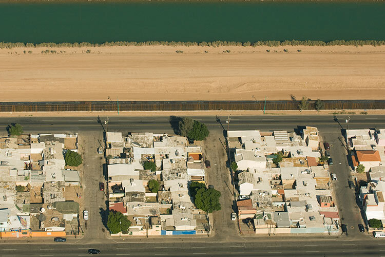
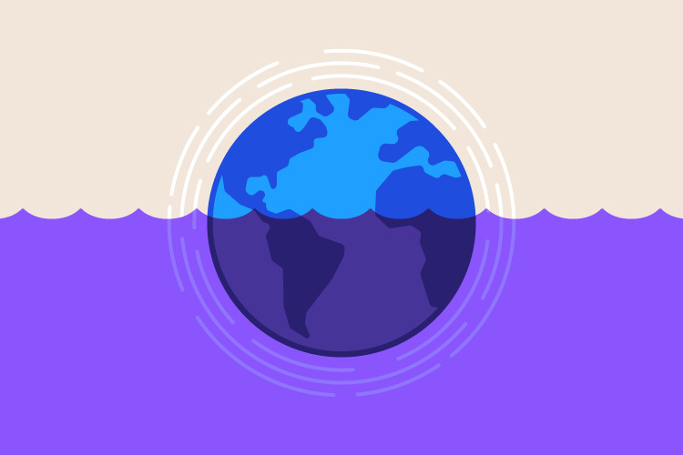
This could be a major breakthrough for Mexico, a country that in 2025 registered the most intense rainfall in the last 43, causing landslides and floods that collapsed homes and caused multiple deaths in various states.
The situation was especially severe because in the country, the programs to predict these hazards have several limitations. “The flood risk maps currently available in the country are static, but vulnerability can change from one day to the next,” says Rosanna Bonasia, a research professor and leader at the Water 360 research group at Tecnológico de Monterrey and leader of the project behind Infrarisk 360.
In collaboration with the University of La Frontera, Chile, the expert and her team have taken risk analysis to the next level: their system allows you to see the areas where there is a higher probability of flooding and, in addition, it reveals different layers, such as the depth and speed of the water, or the vulnerability to damage of a particular area.
“It can estimate which are the pipes or homes that could be most affected,” Bonasia explains.
A Video Game Software for Risk Visualization
One of the technologies that makes this possible is digital twins, a virtual representation of a physical object, process, or system that uses the Internet of Things (IoT), AI, and data analysis to simulate the object’s behavior, allowing for the prediction of failures and informed decisions before making a change or adaptation that prevents damage in the real world.
In the case of Infrarisk 360, the digital twin of the map of the territory to be evaluated is embedded in a computational environment called Unity, generally used in video games.
“It’s a wonderful software for visualization,” says Bonasia. “Within Unity, we implement complex algorithms and AI to perform real-time risk estimations.”
Before starting the simulation, the researchers conduct hydrological studies to provide different flood scenarios. “We have one that corresponds to normal rainfall and another to more intense rainfall, using the probability of an extreme weather event, such as a hurricane.”
The platform is fed with precipitation scenarios derived from these studies, and the user can click on the one that interests them most, then click on the vulnerability of their system and then on the intersection, revealing which structures or elements could be most affected.
“It provides concrete and real information about the impact that flooding can have on a specific area,” says Bonasia.
Future Projections Under Different Rainfall Scenarios
According to the researcher, aside from their platform including technologies that are not usually used to create risk analyses, hydrological studies allow them to project what could happen in the future and to update it constantly over the years.
In Mexico, risk maps are based on data from past rainy seasons, but in the face of phenomena such as global warming, the predicted future scenarios may not be so accurate.
“We can’t know if the next flood in Veracruz will be exactly the same as this one,” the expert says. “When we talk about risk, we have to take into account the variability and chaotic nature of the phenomenon.”
Furthermore, the maps currently available do not exist for the entire republic, as this would represent a significant economic investment due to its hydrological and geomorphological diversity.
Their platform solves this by using innovative technologies to create simulations from pre-existing maps.
The Future of Infrarisk 360
Currently, the platform exists as an online prototype that calculates the risk of damage under different flood scenarios for the infrastructure of Naturgy, a company that supplies energy to homes, businesses and industries.
The company has provided them with information about its gas network in the Monterrey metropolitan area, and with it they have built their platform and conducted advanced risk analyses.
The team is already conducting tests to scale the platform so that it can perform the analysis for the entire metropolitan and conurbation area of Monterrey, as well as Mexico City.
“The long-term goal is to provide this tool to decision-makers and vulnerable communities so they can know what actions to take to prevent damage,” says Bonasia. With it, the country could better prepare for future floods.
Did you find this story interesting? Would you like to publish it? Contact our content editor to learn more: marianaleonm@tec.mx