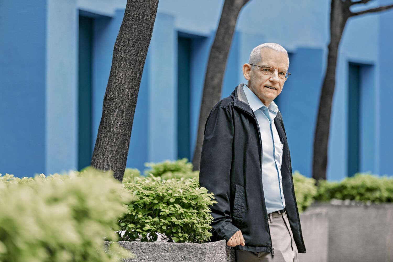


The Zapatista uprising of 1994 marked a turning point in Mexico’s political and social history, but also in Roberto Ponce’s life. Alongside the emergence of the Zapatista Army of National Liberation (EZLN), the Diocese of San Cristóbal de las Casas, led by Bishop Samuel Ruiz, promoted Liberation Theology in Chiapas. This progressive religious movement supported and strengthened community organizing and the defense of Indigenous peoples’ rights in the face of poverty, marginalization, dispossession, and injustice.
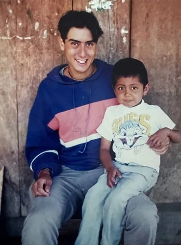
At the time, Ponce was a young man from Morelia who had just graduated from high school and still did not know what he wanted to study. He decided to take a gap year to think about his future and traveled to Chiapas as a missionary with the Marists. “We did community work in Indigenous communities. We would walk for hours through the jungle and spend time with people living in conditions of extreme poverty,” he recalls.
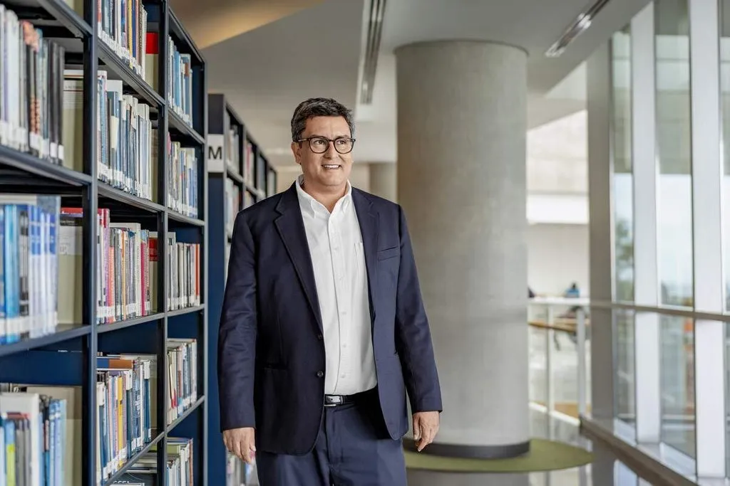
That experience, says Ponce, now a professor at the School of Government and Public Transformation at Tecnológico de Monterrey, made him “grow and mature a lot.” Still, it also left a deep mark on his professional path. Since then, a social perspective has been at the heart of his projects, including the Center for the Future of Cities, which he leads and whose goal is to help transform Mexico’s urban model and improve quality of life in cities. “We use computational models to understand urban phenomena, but also to plan cities that are more connected, inclusive, and sustainable.”
From Mathematics to Changing People’s Lives
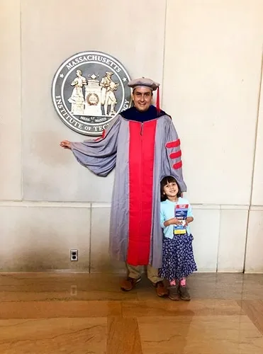
Deeply influenced by his experience in Chiapas, Ponce—once an undecided young man who was good at programming and mathematics but also passionate about the social sciences—chose to study Political Science at ITAM. After earning a master’s degree in Public Policy from Carnegie Mellon University in the United States, he went on to earn a Ph.D. in Urban Studies and Planning from the Massachusetts Institute of Technology (MIT).
What do you consider one of the most serious problems facing cities?
Affordable housing: it has become much more expensive in areas near jobs and public transportation. That is pushing young households to settle farther and farther away, in places where land is cheaper. Beyond sociocultural factors, this phenomenon is occurring throughout the country and even globally. At the same time, these patterns of urban expansion generate many other problems: households moving to the outskirts, traffic, and insecurity, which in turn affect the climate. More sprawling cities are more dependent on cars. This is what concerns me most; finding ways to make housing more affordable is difficult.
You made the transition from politics to urban planning…
After I graduated, I worked in the Office of the President of Mexico as deputy director of research in the Public Opinion Coordination Office. There I learned to use geographic information systems for different social issues, and that was my entry point into urban studies. I didn’t know what urban planners did, but I became interested in how patterns form within cities and how social groups and urban poverty are distributed.
Do cities develop similar patterns, or do their dynamics vary widely?
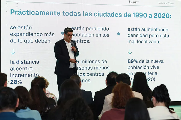
Both. Every city has its own character, but common patterns also emerge. In a study we recently published in Nature Communications, we examined how urban growth has unfolded across 70 metropolitan areas in Mexico over the past 30 years. We found a common pattern: rapid urban expansion, with increasing land consumption, accompanied by growth on the outskirts and population decline in the central areas of Mexican cities.
This is concerning because we are losing population precisely where we have the best infrastructure, while continuing to grow in areas where services still need to be provided. The result is cities that are increasingly spread out and more dependent on private vehicles.
And this pattern is not unique to Mexico. We see it in the United States, China, and South America as well. It is a global problem.
Toward Transforming Mexico’s Urban Model
What did you learn from your experience at MIT?
I developed a very interdisciplinary view of urban issues and learned the importance of working with teams that bring together different perspectives. That is why, at the Center for the Future of Cities, I have sought to bring together people with very different backgrounds: sociologists, architects, mathematicians, physicists, computational scientists, designers…
On the other hand, when I returned to Mexico after living in the United States, I realized that here, urban issues were closely tied to architecture. When I took part in my first urban planning projects, I realized that the way we do planning in Mexico was not working, and that led me to explore new approaches. At Tec, our team has developed its own space within computational urbanism, supported by tools such as Scenario Planning.
What does it involve?
It is an alternative approach to urban planning in Monterrey based on modern methods, combining qualitative and quantitative approaches to understand current challenges and explore better possible futures. It has become a central focus at the Center for the Future of Cities: how can we help transform these planning models in Mexico?
Why do you say that most urban planning models used in Mexico do not work?
They are based on outdated methodologies. In the United States, a major planning movement in the 1950s called the Master Comprehensive Plan became the standard in other countries. It includes a lengthy diagnosis—around 500,000 pages—covering many issues, such as public safety, earthquakes, public facilities, housing, and crime. Then, in a very rudimentary way, these elements are combined to show what a municipality or city might look like. This model evolved in the United States, but in Mexico we got stuck. It is still what is taught in schools; what public officials are trained to do; and what consultants use as well. But the only part of the plan that ultimately proves useful is land-use regulation. There is no real territorial planning.
Where should urban planning be headed?
First, we now have much more sophisticated tools for simulating possible futures. Community participation is also very important. We need to consult people from the beginning, ask them how they see their territory and what they envision for it.
What are the challenges facing your field?
Artificial intelligence has arrived as a revolution, and it is also transforming computational urbanism. We are now riding that wave and exploring how to apply these tools to the study and planning of cities. The real challenge is to bring machine learning and artificial intelligence tools out of academia and ensure governments use them effectively in urban planning.
What do you do with your time when you are not analyzing urban maps?
I spend almost all my time with my 12-year-old daughter. Every day I go for walks with her and our dog. My wife and I really enjoy traveling and the culture surrounding wine and tequila. I also enjoy movies and literature.
What novels are among your favorites?
I like classic literature. I have read Don Quixote a couple of times because I find it so much fun. The Savage Detectives, by Roberto Bolaño, is one of the books I love most, along with Hopscotch, by Cortázar, and the books of Carlos Fuentes and Umberto Eco. But I also read contemporary literature, especially works by a new generation of Mexican women writers, such as Fernanda Melchor, Valeria Luiselli, and Guadalupe Nettel.
Last year I read Gonzalo Celorio’s trilogy, and I loved it. He recently won the Cervantes Prize. I also read a lot of nonfiction and journalistic narrative. Svetlana Alexievich is one of my favorite authors.
Ideal Cities and Other Projects
One of the projects Ponce is most proud of is Ciudad Finita, a platform that integrates and visualizes data on urban growth, land use, and territorial dynamics in Monterrey. The platform makes it possible to characterize how the city has grown and highlight the impacts of urban expansion, with information on key issues such as public safety and inequality. “Because precisely in the urban outskirts, where population growth is occurring, there are few businesses and few schools.”
Although cities are his area of expertise, throughout his career Ponce has also worked on projects far removed from urban issues but connected by a common thread: the use of technology and data visualization platforms. In the United States, he collaborated on a government project to automatically identify tweets spreading fake news. In Uruguay, he worked on One Laptop per Child, an initiative aimed at giving every elementary school child access to a computer to improve learning. And during the pandemic, he devoted much of his time to MexicoVid, a Tec platform that used maps to visualize how infections were spreading across states and municipalities during the pandemics.
Do you have a favorite city?
I really like Rio de Janeiro and Buenos Aires because of their proximity, their beaches, and the fact that you can see people walking around. Medellín is an exceptional case of urban revitalization: a city that went from being one of the most violent in the world to offering a high quality of life today.
What other projects would you like to work on?
We have an exciting project we want to launch next year, coinciding with the 2027 election. It is called Techvoto, a platform with a comprehensive archive of Mexico’s electoral processes, where users can easily explore the history of election results and download the data.
I am still very interested in the social impact of public policy, and I think that has a lot to do with that experience with the Marists, which allowed me to encounter a reality I had never experienced before. It deeply marked me, opened up a whole new world, and showed me a reality I had never seen. I have never forgotten it. It made me realize that social issues would always be at the heart of what I do.
Did you find this story interesting? Would you like to publish it? Contact our content editor to learn more at marianaleonm@tec.mx