

Although Monterrey may seem like a dry city, a network of creeks winds through its neighborhoods and avenues, helping regulate temperatures, channel rainwater, and connect ecosystems.
Over the decades, many of these waterways have become illegal dumping sites where tons of trash accumulate. This problem is not unique to Nuevo León. According to the United Nations Environment Programme (UNEP), one out of every three pieces of waste ends up in open dumps, contributing to soil, water, and air pollution across the region while posing risks to public health.

To address this challenge, researchers at Tecnológico de Monterrey are developing a project aimed at restoring the Seco–San Agustín Creek, a waterway that originates in the Sierra de Chipinque in the municipality of San Pedro Garza García. It flows for more than 13 kilometers through Monterrey before emptying into the La Silla River near the city limits with Guadalupe.
Known as Arroyo Vivo, the initiative brings together research, data science, technology, and community engagement to restore the creek while developing a model that can be applied to other urban waterways, explains Nélida Escobedo, a professor at the School of Architecture, Art, and Design and a researcher at the Tec’s Center for the Future of Cities.
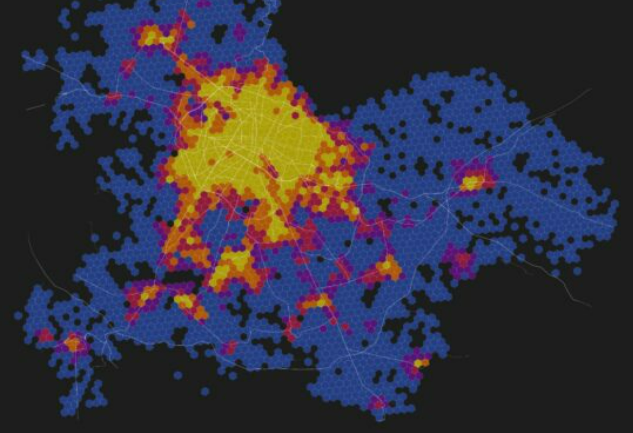
“It’s a platform built around a long-term vision. Our goal is to establish an intervention model that can be replicated and spark a process of ecological, social, and urban regeneration in the Seco Creek,” she says. “These are places where vegetation helps lower temperatures. For example, our measurements have shown that areas along the creek can be as much as 10 to 15 degrees cooler than nearby asphalt-covered areas.”

A living laboratory to restore the Seco–San Agustín Creek
The project operates as a living laboratory where researchers test technological tools, community-based strategies, and urban interventions to develop a model that can be replicated elsewhere.
It began as an initiative led by the Monterrey Climate Action Alliance (ACA-MTY), in collaboration with Tecnológico de Monterrey, the World Wildlife Fund (WWF Mexico), the nonprofit organization Sociedad Sostenible (SOSAC), and Fundación FEMSA. During its initial phase, the project also received funding from the U.S. government through the National Oceanic and Atmospheric Administration (NOAA).
Its goal is to restore and revitalize the creek by strengthening biodiversity and the social fabric through the creation of a biological corridor where residents can reconnect with the natural environment.
A biological corridor is a natural area that links separate ecosystems, allowing plant and animal species to move between them. In the case of Arroyo Vivo, the creek connects the Sierra de Chipinque with the La Silla River, enabling the movement of a wide range of species, including wild boars, birds, insects, turtles, and even the North American beaver, a species considered endangered.

Technology and algorithms to better understand pollution
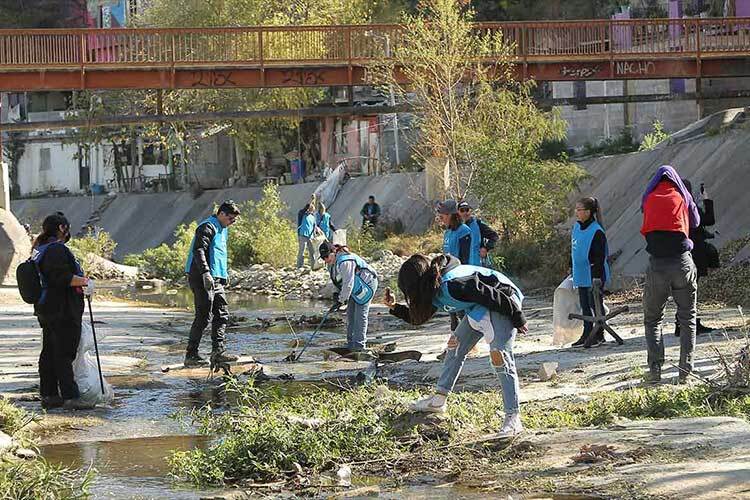
During the first phase of the project, the team organized 16 volunteer cleanup events. Everything collected was weighed and sorted so the data could be used as input for research aimed at better understanding the problem. “We’ve conducted manual surveys using a mobile application, Marine Debris Tracker, with people visiting the site and identifying the different types of waste found in the creek.”
In total, the team removed 21 metric tons of waste. They also found that more than 70% of the trash consisted of plastics. Textiles were the second most common type of waste, followed by tires and construction debris.
For the project’s second phase, the team has the support of Fundación FEMSA to develop its own technology for automating waste identification and classification using computer science and algorithms to analyze images available through Google’s geolocation platforms, as well as photographs shared by community members during site visits.
“We’re breaking new ground because Google Street View analyses are typically used to study other environmental indicators, such as building height or tree cover, but very little work has been done on using these images to measure waste,” the project’s lead researcher says.
The goal is to create a tool capable of automatically identifying both the type and volume of waste in the creek. The resulting data will help establish a more accurate baseline for pollution levels and make it easier to monitor changes over time.
Working together to transform the creek
As part of the initiative, the researchers are also working with students from a CBTIS technical high school located near the creek. The students have taken part in workshops on sensor programming, technology, and environmental stewardship. The team hopes local communities will become active participants in the initiative, helping restore the ecosystem while creating a model that can be replicated in other projects.
“We want to build this model collaboratively through a highly inclusive process that brings together the communities living alongside the creek, academia through the Center for the Future of Cities, and, of course, government agencies and private-sector partners to create a robust framework for action,” the researcher says.
She adds that the educational component, combining knowledge, teaching, and technology, can play a key role in launching restoration and regeneration efforts rooted in school communities, with students and children at their core.
The project also aims to create a positive social impact by advancing environmental justice, reducing the harmful effects of pollution on local communities, and lowering the flood risks faced by residents living near the creek during periods of heavy rainfall.
“The creek flows through neighborhoods with very different socioeconomic profiles. It begins in the upper section, known as San Agustín Creek in San Pedro, where it remains in a largely natural state. But it then passes through the La Campana–Altamira area of Monterrey. That’s where social inequality and ecosystem vulnerability present major challenges. It’s the section where the creek experiences the highest levels of pollution, and where neighboring communities are also among the most affected.”

The team is currently developing a three-, five-, and ten-year roadmap to solidify the Arroyo Vivo model. The researchers plan to test the various strategies developed during this phase, learn from the results, and refine a methodology capable of restoring other urban ecosystems through a comprehensive, integrated approach. Although the researcher acknowledges that restoring a waterway of this kind can take several decades, she hopes the process will lay the groundwork for lasting transformation.
“We aspire to create a model that inspires communities, governments, and the private sector to take part in projects like this,” the researcher says. “We envision becoming a model that provides data, methodology, and technology, and one that can inspire the transformation of other ecosystems.”
Were you interested in this story? Do you want to publish it? Contact our content editor to learn more marianaleonm@tec.mx